
Historic Photo Collection - Views of Evansville and the Tri-State
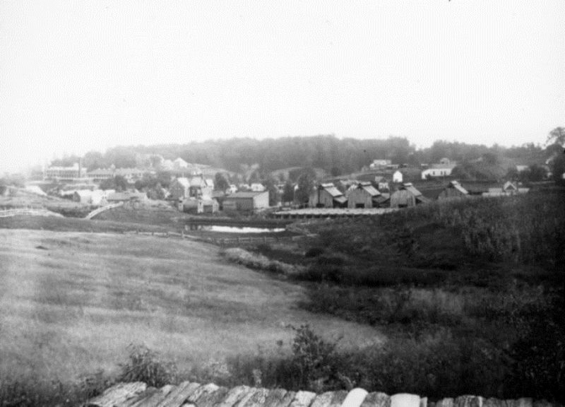
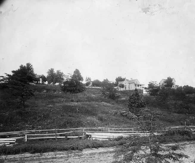
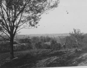
Babytown (Reitz Hill): View of the West Side, looking towards the Marine Hospital (left), which was located at 2700 W. Illinois St. Behind that, on a hill, is the orphanage, and a brickyard lies in the foreground; c. late 19th-century (Riggs Collection)
Deaconess Hospital Neighborhood: View towards the west from hospital complex; St. Anthony’s Catholic Church, near intersection of First Ave. and Columbia St., is visible in top right; photo dated September 1986 (Deaconess 1)

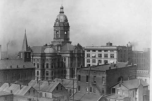
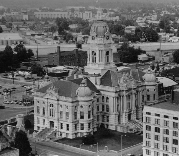
Downtown: The Vanderburgh County Courthouse is at left, and Central High School’s tower is visible at the right; c. 1960 (Meyer-Schlamp 507)
Downtown: Old Vanderburgh County Courthouse in background (view towards the intersection of Fourth and Vine Sts.); early 1900s (Knecht 3192)
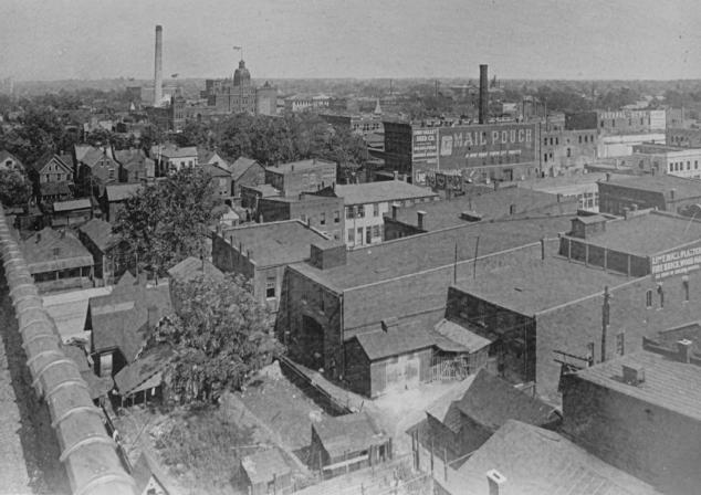
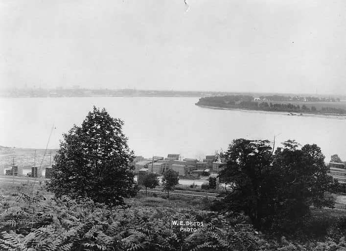
Downtown: Looking towards the (south)east; the F. W. Cook Brewing Co. (flag flying atop its tower), located on Seventh St., can be seen in the distance (Deeds 49)
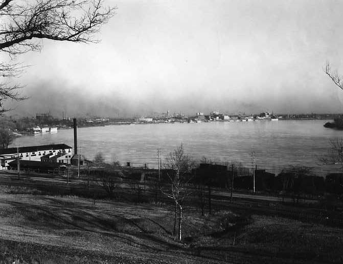
Downtown: View of downtown (center background) from far west side of city (lumber yard in foreground by the river); photo dated December 6, 1928 (Meyer-Schlamp 185)

Downtown: Setchell Stables on NW Second Street is in the foreground; view looks southwest; c. 1880 (Hammond 8)
Downtown: View of the city (in hazy distance) from the far west side; early 1900s (Knecht 3816)
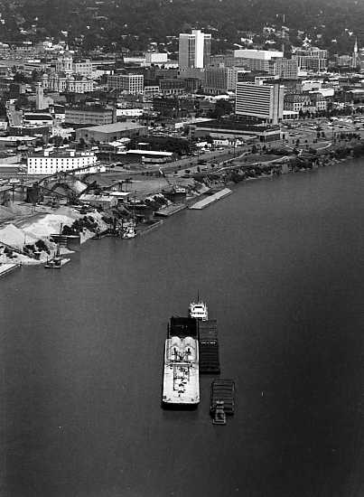
Downtown: Barge headed toward the riverfront (old Courthouse in upper left corner); photo dated 1985 (7PC 51)
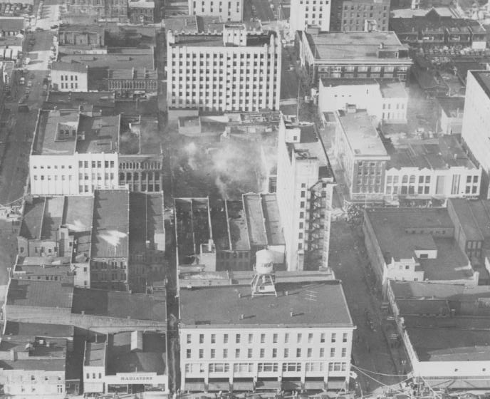
Downtown: Aftermath of a fire in 1951 (smoke in center) on Main St. between Third and Fourth Sts.; Shear’s Department Store is in the center foreground (Knecht 885)

Downtown: View from Third St., looking towards the river; c. 1920s (Knecht 4493)
Downtown: View from Citizens Bank on Main St., looking southeast (St. Mary’s Catholic Church at upper right); photo dated 1928 (Gaisser 12)
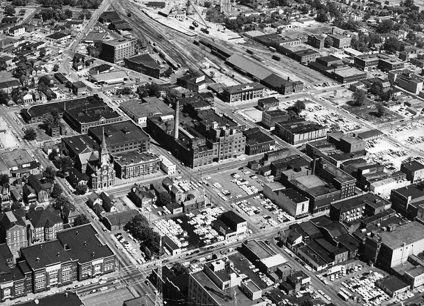
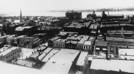
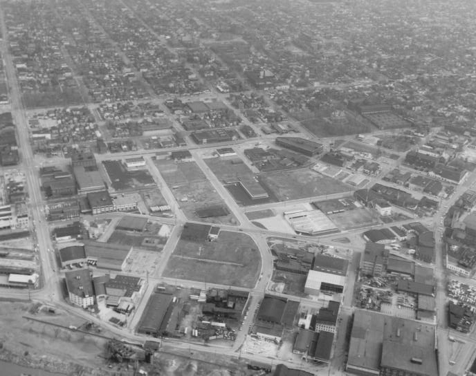
Downtown: General area where the Civic Center now is: Seventh St. (now Martin Luther King Dr.) runs through center of image; old Central High School at lower left; c. 1950s (Knecht 151)
Downtown: View towards the southeast, with the Old Vanderburgh County Courthouse in center; c. 1920s (Knecht 1009)
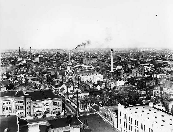
Downtown: View towards the east; Central High School is at lower left, Assumption Church (Seventh St.) near the center, and to right of church is Cook’s Brewery (white smokestack); c. 1930s (Meyer-Schlamp 99)
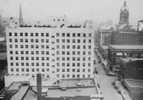
Downtown: Central Union Bank (later, the Hulman-Vectren Building) on NW Fourth St.; the Old Courthouse, Court Building, and Sears Company can be seen at right; c. 1930 (Knecht 791)
Downtown: View towards the southeast; the roof of the Hulman-Vectren building is at lower left, and St. Mary’s Catholic Church is visible at upper right; c. 1930s (Meyer-Schlamp 100)

Downtown: Looking towards the Ohio River (photo from a book published in April 1932 by the City Planning Publishing Co., Boston)

Downtown: Central High School tower visible at left; to right is Assumption Catholic Church steeple; photo dated October 18, 1928 (Bolin 3)
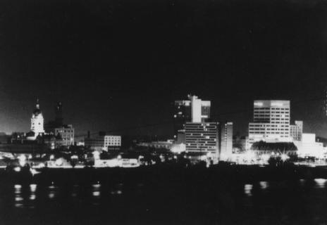
Downtown: View from Reitz Hill at night; photo dated 1983 (Center City 23)
Downtown: St. Mary’s Catholic Church steeple at left; the new McCurdy Hotel under construction (center, near the river); c. 1916 (Payne 31)
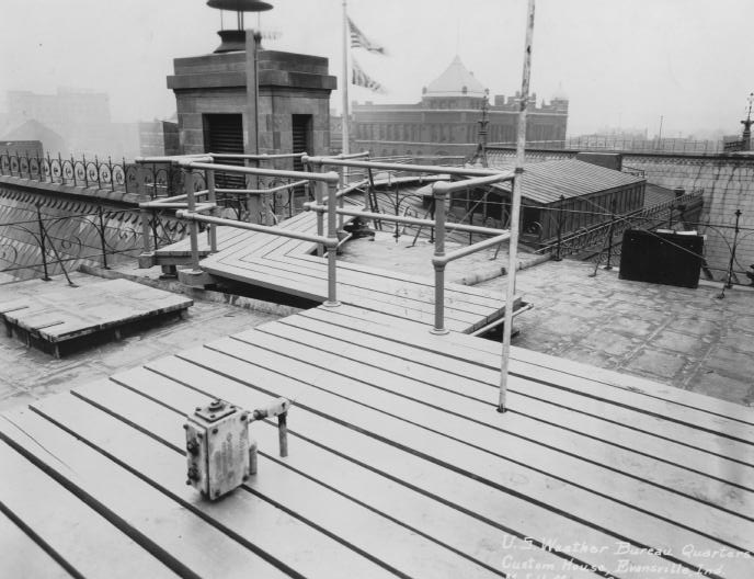
Downtown: Looking towards Main St. from the roof of the Post Office and Customs House; building also housed the U. S. Weather Bureau quarters; c. 1917 (Post Office 43)
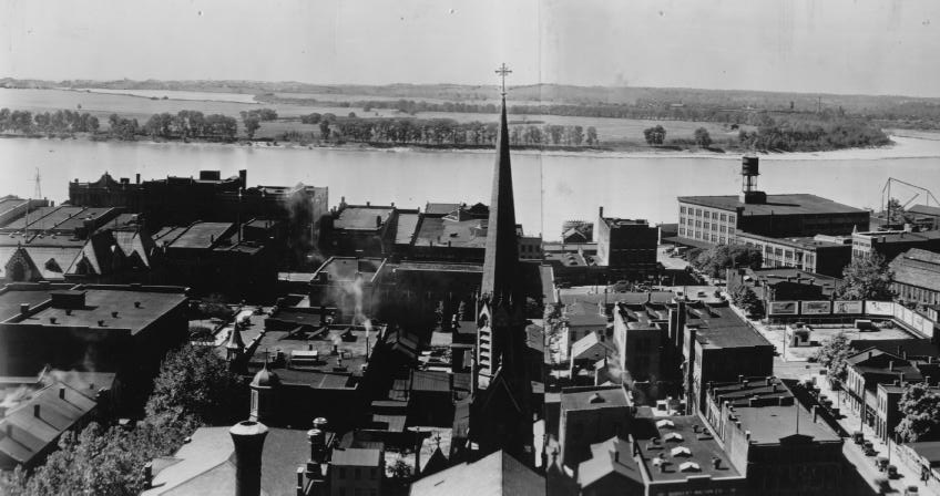
Downtown (Part 1 of 2): Looking towards the Ohio River, probably from the top of the Courthouse (Holy Trinity Church tower in center of photo); c. 1935 (Knecht 3453)
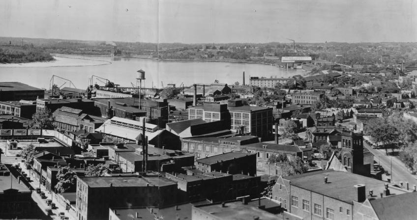
Downtown (Part 2 of 2): Looking towards the west (Mead Johnson Terminal and Reitz Hill visible in background); c. 1935 (Knecht 3453)

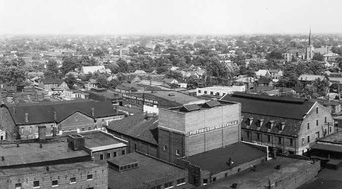
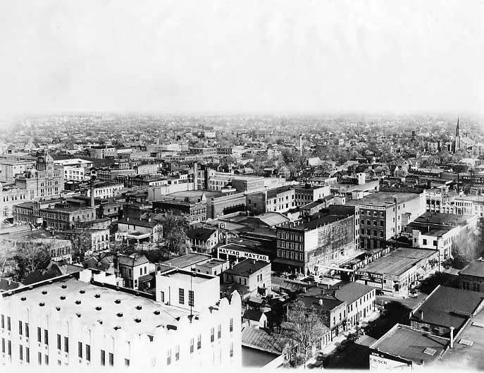
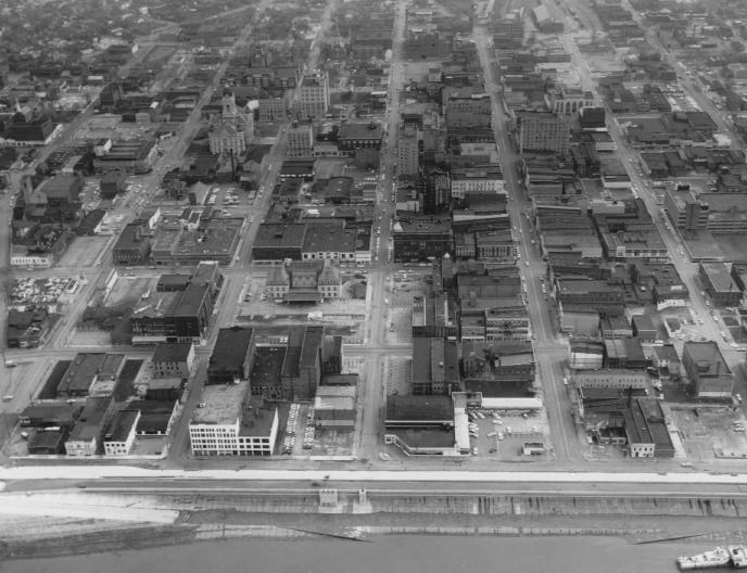
Downtown-East Side: Main St. (center street) curves to the left; near center are the old CE&I railroad station and depot; Assumption Cathedral and F. W. Cook Brewing Co. are in lower left; c. 1960s (VC 34)

Downtown-Near North Side: The Old Vanderburgh County Courthouse, Court building, and Sears building (under construction in foreground); c. 1925 (Willard Library Collection)
Downtown-Near North Side: NW Riverside Dr. (bottom) turns into Fulton Ave. at left, with Division St. intersecting middle of picture; c. 1960 (Fitzgerald 78)
Downtown-Near North Side: Old Vanderburgh County Courthouse in foreground; photo dated 1986 (8PC-96)
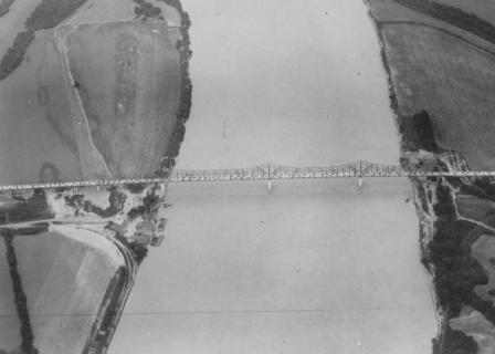
Evansville-Henderson Bridge: C. 1940 (Knecht 886)
First Avenue and Franklin Street: View looking southeast towards downtown Evansville, taken from the roof of the Crescent Furniture Co.; pre-1910 (Sabel 11)
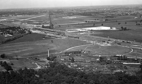
Highway 41 (North): Airport and present-day Whirlpool factory visible in upper left; Sunset Drive-In Theater (white area), upper right; c. 1950s (Winterman 62)
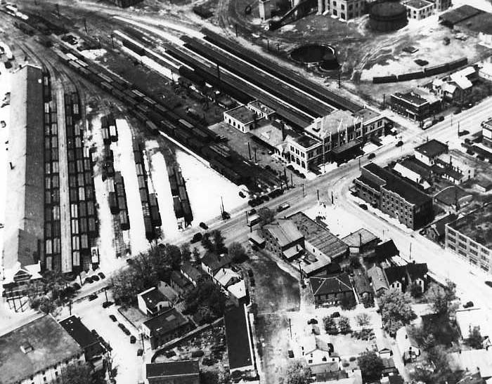
L & N Railroad Depot: Fulton Ave. at NW Second St. (depot in upper right of intersection); c. 1930s (Miscellaneous Collection 593)

Lawndale Shopping Center: The Lawndale shopping center under construction in the mid-1950s; the street in the foreground is Green River Rd. View looks toward the northeast. (Worthington 2)

Lawndale Shopping Center: The Lawndale shopping center under construction in the mid-1950s, looking towards the southwest and showing the rear of the development (Worthington 3)

Lawndale Shopping Center: Overhead view of the newly-opened Lawndale shopping center (center) on Green River Rd.; the large field at the right is where Washington Square Mall was built a short time later; c. late 1950s (Worthington 4)

Lincoln Gardens Site: View of area cleared for construction of the Lincoln Gardens housing project (Lincoln High School is in foreground); photo dated 1937 (Knecht 780)
Methodist Hill (Newburgh, IN): Looking north from the Ohio River; early 1900s (Knecht 4831)

Mt. Vernon, Indiana: The commercial and residential areas near the riverfront; the County Courthouse is at the center of picture; c. 1940s (VC 35)
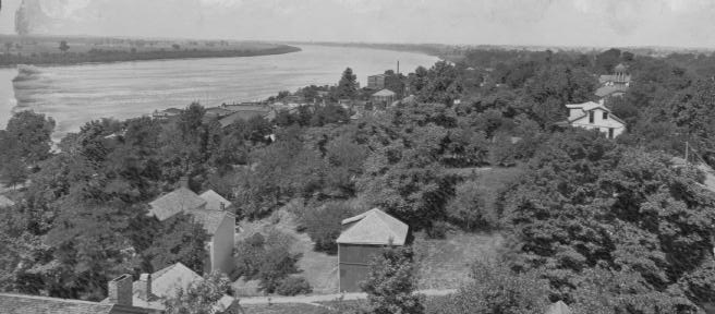
Newburgh, Indiana: Looking east towards Evansville down the Ohio River; c. 1915 (Knecht 5073)
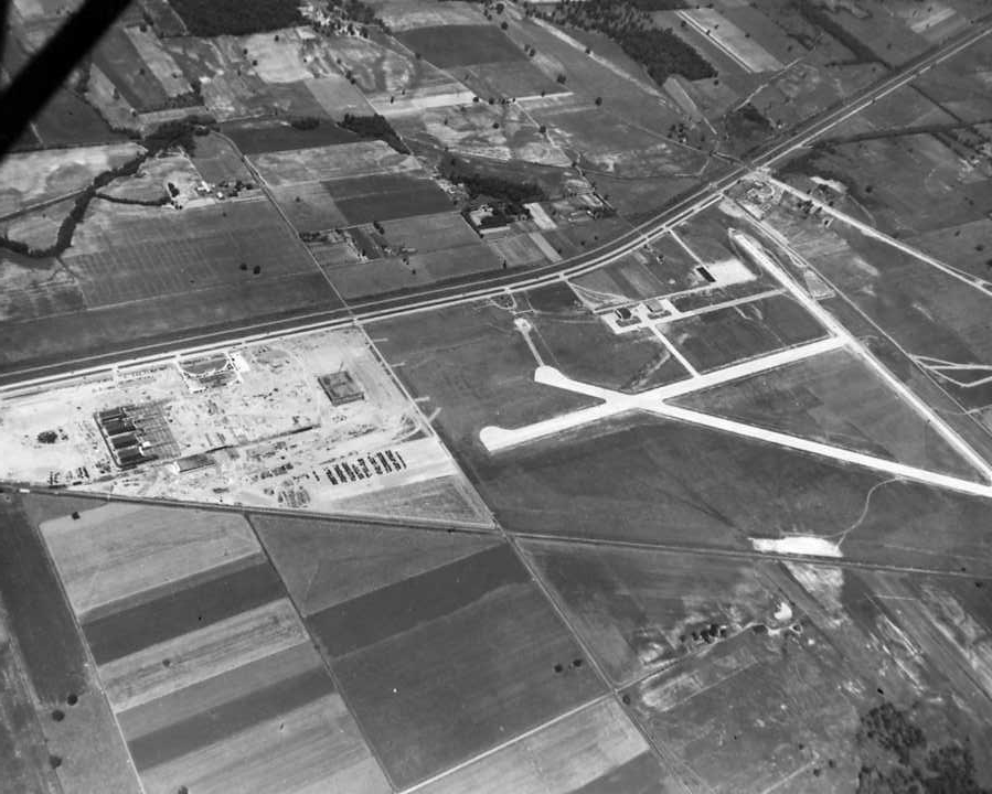
North Side: The Republic Aviation plant (under construction) is visible at center left, and the airport is at center right; 1942 (Marchand 16)

North Side-Airport: Airport located between Highway 41 (left) and runway; c. 1940s (VC 52)

Oak Hill Cemetery: View of region around Oak Hill Cemetery; c. 1920s (Knecht 2110)
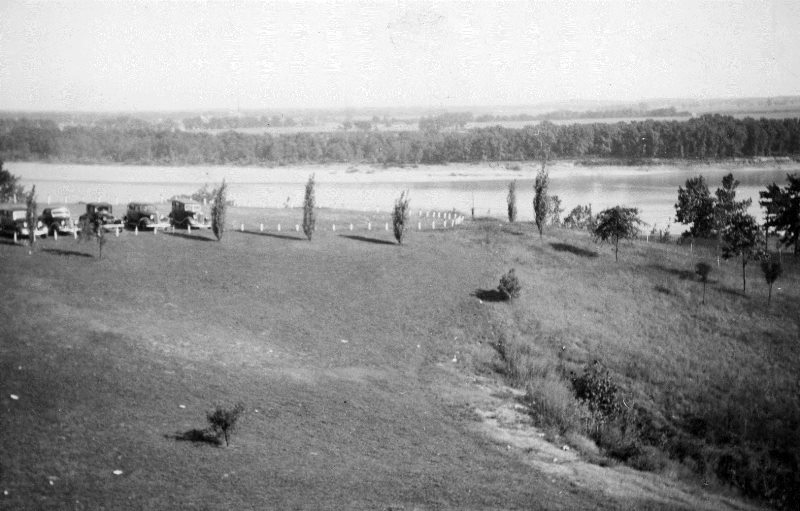
Ohio River: View of the river taken from a window at Reitz High School; a section of the student parking lot is visible at left; c. 1940s (Reitz 13)

Ohio River and West Side: View from the riverfront, looking towards the Mead Johnson Terminal (right) and the West Side; the SIGECO plant is in the distance at left (Reitz 15)

Pigeon Creek-West Side: Pigeon Creek, bounded by W. Franklin St. to the north, Eighth Ave. (west), and Seventh Ave. (east), where it empties into the Ohio River; c. 1888 (Marchand 1027)
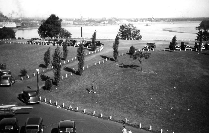
Reitz Hill and Ohio River: View of parking lot at Reitz High School, looking towards the Ohio River and downtown Evansville; the Mead Johnson Terminal is visible in upper left; c. 1940 (Miscellaneous 1676)
Riverfront: Photo dated 1919 (Knecht 871)
Riverfront: View from across the Ohio River; c. 1916-1923 (Knecht 3796)
Riverfront and Downtown: Photo dated 1960 (Fitzgerald 2)
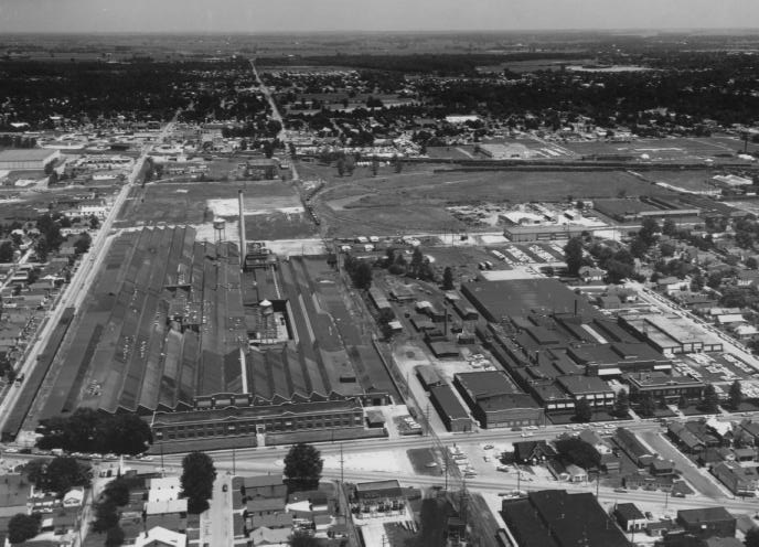
Stringtown-North Garvin Street: Foreground: former Graham Bros./Chrysler-Plymouth Plant buildings; c. 1950s (Fitzgerald 7)

View from Reitz Hill: Photo taken from a window at Reitz High school in the 1940s; in the foreground is the SIGECO plant (Reitz 14)
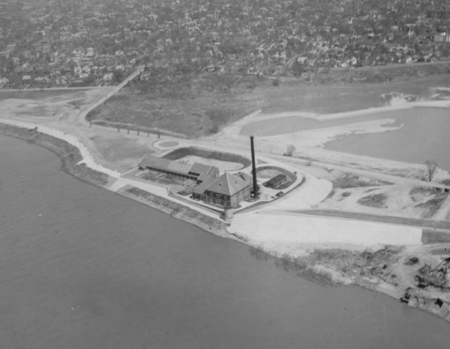
Water Works Plant: C. 1940s (VC 46)
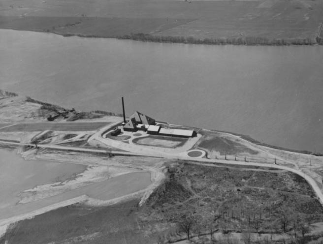
Water Works Plant: Looking south across the Ohio River towards Kentucky; c. 1940s (VC 47)

West Side: Looking northeast from Reitz Hill; c. 1930s-1940s (Meyer-Schlamp 1033)

West Side: Lumberyard in foreground; c. 1890s-1910 (Riggs 10)

West Side: Preparations for the pavement and extension of Highway 62 west of St. Joseph Ave.; the arrow (foreground) designates the Barker Ave. overpass; photo dated June 23, 1956 (Knecht 697)

West Side: Looking east from the tower of Centennial School; the street in the center of the image is probably Illinois or Indiana Street.; late 1800s (Miscellaneous Photo Album)

West Side: Spires of St. Boniface Church visible in the distance; c. 1920s – 1930s (Henry Meyer Collection)
West Side: Mesker Park area; c. 1930 (Knecht 1468)
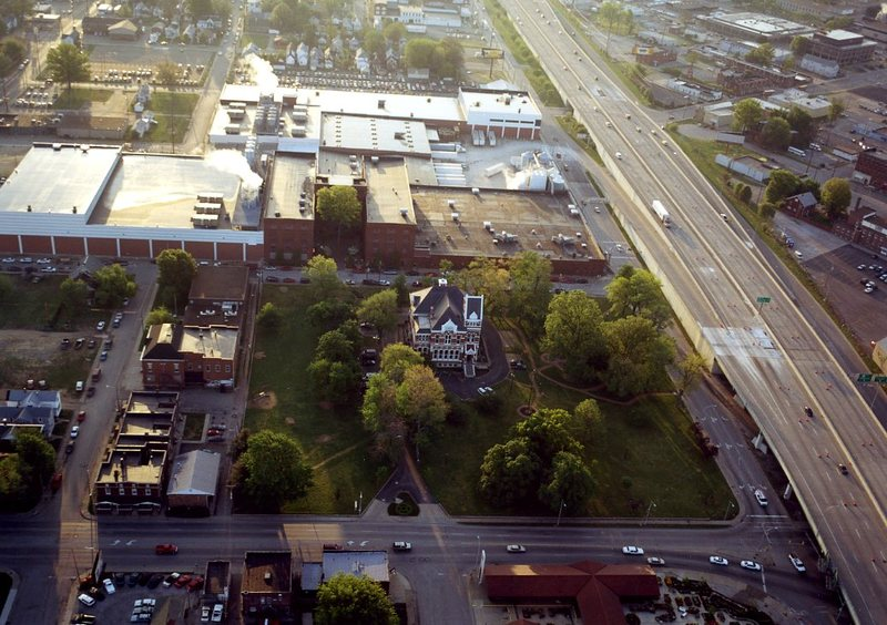
Willard Library: Willard Library and Park (center), one block north of the Lloyd Expressway (right) on First Ave.; behind the library is Berry Plastics Co.; to the left is Illinois St. and the old Boys & Girls Club building; c. 2005 (Willard Library 440)